The romance of the Russian northern hinterland attracts tourists with its silence and grandeur. Endless forests, hills and mountains, deep lakes and fast winding rivers of the Vologda region acquire a special charm during the white nights. The largest number of natural monuments is located on the territory of the Velikoustyug district. Several reserves are located on the banks of the Sukhona River, which amazes with its beauty along its entire length.
In 2016, the region became the best destination for ecological tourism in Russia, which is gaining more and more popularity. There are important geological sites as well as archaeological sites of scientific interest. Of great value are areas of untouched forests, which have preserved trees over 100 years old, rare plants and animals.
Natural monuments of the Vologda region
List, photos with names and descriptions of places worth visiting!
Opoka geological outcrop
The outcrop is a steep right bank of the Sukhona River, 60 km from Veliky Ustyug. The height is about 70 meters. On the slope, layers of marls and clay of the Permian period are clearly visible, in which the fossilized remains of ancient mollusks and paw prints of lizards have been preserved. Nearby there is a very dangerous river threshold of the same name, and a little upstream - a gushing spring.

Mount Tsipina
An ideal place for a relaxing holiday, one with nature. One of the highest points of the Vologda Oblast is 210 meters. Hangs over Lake Ilyinskoye, from its height a view of all the nearest surroundings opens. The mountain is located on the territory of the Russian North National Park. The largest ski resort in the Vologda Oblast is located here, with comfortable slopes and recreation centers.

Mount Maura
One of the interesting objects of the park "Russian North". The height of the mountain is only 185 meters, and its slopes are densely overgrown with forest. The very process of climbing is a walk through untouched places with unusually clean air. A chapel was built on the top of the mountain, from the second floor of which you can see the surroundings and the Kirillo-Belozersky Monastery. There is a famous footprint next to the chapel. According to legend, if you touch the footprint on it, any desire will come true.

Valley of the Tagazhma River
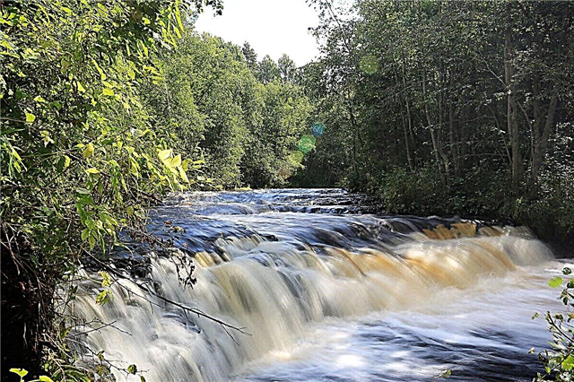
In the Vytegorsky district, 12 km from the village of Vytegra, there is a specially protected natural area. This is a 10 km long section of the Tagazhma valley. Here the river flows along the bottom of the canyon, cut into the strata of the Lower Carboniferous rocks. There are many rapids along the entire length, but the largest is the Padun waterfall. Its height is only 1.5 meters, but it is very wide and full of water at any time of the year. A hole 3.5 meters deep has formed under it; grayling is found here.

Stone mountain
On the western outskirts of the city of Babaevo, there is a protected natural area that covers an area of 32 hectares. The mountain has an ancient origin, formed by the descent of a glacier. Its height is about 30 meters. The slopes are densely covered with pine forest, and the air is unusually clean here. This is a place for outdoor recreation and walking for the townspeople. It is not only of recreational value, but also of scientific interest. There is a sanatorium at the foot.

Olarevskaya ridge
This natural monument is one of the seven miracles of the Sokolovsky region. It includes a swell of glacial origin with a width of 3 to 5 km and 160 hectares of adjoining territory. The entire ridge is a system of hills overgrown with pine forests. Rare species of herbaceous plants and many songbirds can be found under the forest cover. There are also boulders of glacial origin, overgrown with lichen. They say that there are anomalous zones in these places.

Andoma mountain
On the shore of Lake Onega, on the territory of the Andomsky rural settlement, there is a unique geological section formed by the movement of the glacier. The mountain is made up of deposits of multi-colored sandstones; there are fossilized remains of ancient fish and trees. The deposits are about 400 million years old. The absolute height of the hill is 85 meters. The steep shore of the lake is a geological outcrop, in which the different colors of ancient rocks are clearly visible.

Sokolsky Bor
The forest on the territory of the Kirillovsky district is located on the territory of the Russian North national park, on the banks of the Sheksninsky reservoir, near the village of Topornya. Occupies an area of about 800 hectares. The pine forest is a habitat for southern taiga plants and a habitat for rare representatives of the fauna of the Russian north. There are a lot of berries in the forests, there are 7 types of orchids, one of them, the lady's slipper, is the symbol of the national park.

Vaskin Bor
The natural monument is named after the cape of the same name, which is located on the shore of Lake Lozsko-Azat, in the Belozersky region. The cape is a hill formed by the layering of various sandy and pebble rocks, they are clearly visible in the outcrop. Pine forest on sandy soils, picturesque views of the lake from the top of the cape, clean air - all this attracts numerous tourists. Also, these places are of archaeological value; traces of ancient sites have been found here.

Cape Bull
In the lower reaches of the Sukhona River, in the Velikoustyug district, there is an unusual, very picturesque place. The cape is an erosional outlier formed at the mouth of the Upper Yorga River. The best view of it comes from the high bank of the Sukhona: the shape of the cape resembles the figure of a bull lying on the bank and drinking water. Local legends about secret robber caves are connected with him. In addition to its aesthetic value, the hill is of geological interest.

Vaskin Klyuch waterfall
The waterfall is located 3 km from the village of Nizhnyaya Tozma, Velikoustyug district. Its height is 10 meters, and its estimated age is more than 300 years. The water flow originates 5 km from the exit to the surface, at the bottom of the Devil's Lake. The water in the spring is always cold, no higher than 7 degrees. The territory at a distance of 500 meters on both sides of the key is also under protection in order to preserve endangered plants.

Mount Sandyreva
The mountain has a height of 173.6 meters and covers an area of 15.53 hectares on the territory of the Russian North park. This is one of the highest points of the park; it is unique not only for its landscape, but also for its geological structure. The mountain is almost treeless, with outcrops of calcareous and igneous rocks. Due to the absence of dense forests from the top, views of most of the Kirillovsky district open up.

Lake Black
It is located in the Babaevsky district, near the village of Sergeevo. It is surrounded by swamps on almost all sides; there is an approach from one side through a small area of forest. The area is 122 hectares, the depth is up to 9 meters, the bottom is silty. The lake itself and 300 meters of the coastal area are a natural monument. Rare species of plants and birds are under protection. There are a lot of fish in the lake, there is a belief that there is also a mysterious lake monster that looks like a giant pike.

Bor "Black Sands"
It is located on the territory of the Prionezhskaya lowland, in the Vytegorsky region. Occupies a hilly plain left over from the lacustrine basins of the Ice Age. Lichen and lingonberry pine forests are especially protected. The main part of the pine forest is located in the area of Cape Borovskaya. In addition to rare reliefs and landscapes, these places are of historical value. The remains of the fortifications of the Great Patriotic War have been preserved here.

Natural boundary "Colored flints"
It is located in the Velikoustyug district, near the village of Krasavino. It is an almost steep bank of the Sukhona River, 50-60 meters high. The site is 2 km long and is located between the mouths of the Markovka and Semzha streams.On the slope of the coast, layers of ancient rocks of the Permian period are clearly visible, and at the foot - particles of colored flint and quartz, amethyst and calcite are found. There is a recreation center in a village surrounded by coniferous taiga.

Baranovsky Bor
It is located on the outskirts of the village of Baranovo, Velikoustyug district. It is a 206 ha area of pine forest along the Yug River. The trees are 140 years old or more. In total, there are 63 species of various plants in the forest, including rare ones. Locals and guests alike pick mushrooms and berries here. Bor is filled with clean, healthy air and the indescribable atmosphere of an untouched forest.

Tract-Kirika and Ulita
The tract is named after the village and is located 7 km from Vologda. It is a hilly plain, partially covered with spruce forest, through which the Shogrash River flows. In the channel there are large boulders brought here by the glacier. The tract is known far beyond the borders of the region thanks to the holy spring. The coniferous forest is one of the few tracts that have survived in the vicinity of Vologda. Elks, wild boars, squirrels live here, there are up to 110 species of birds.

Geological outcrop Myakolitsa
The natural monument is located on the right bank of the Sukhona, 2.5 km below the mouth of the Myakolitsa River. The cliff here has a height of 60 - 70 meters, exposing the layers of the Tatar stage of the Permian period. Among the layers there are large lenses made of sandstones, in which the remains of ancient lizards have been preserved. The reserve also includes the adjacent forest area, in which rare plants are protected.

Mikhaltsevskaya (Kuvshinovskaya) grove
The pine-spruce massif, which has 120 species of plants, is located on the banks of the Vologda River, near the mouth of the Toshna. This is the only pine grove that has survived in the vicinity of the regional center. It is closely adjacent to the village of Kuvshinovo and is located on the lands of the agricultural cooperative "Plemzavod Maisky", therefore it can be considered a forest park zone. Occupies an area of 36 hectares.

Kodozero
Located 2 km from the village of Krasnaya Gora, Babayevsky district. The water area of the lake and 300 meters of the surrounding coastal territory are under protection. It is part of a system of lakes connected by channels. Surrounded by forest and swampy areas, the banks are heavily overgrown. There are 2 small villages on the banks. There are 20 species of rare plants and 3 of the Red Data Book, perch, roach ruff, crucian carp, and pike are found in the lake.

Isakova Gora
The hill is 293 meters high and is the highest point of the Northern Ridges. It is located in the Babushkinsky district, on the slope of the mountain is the village of Isakovo. The formation is associated with the movement of an ancient glacier, the hill is composed of clay, karst phenomena are observed. The top and slopes are covered with spruce forest with raspberries. The natural monument is of scientific interest and is included in most of the ecological tourist routes.

Devyatinsky perekop
In the 19th century, an artificial canal was built in the bend of the Vytegra River in order to straighten the winding channel. This was necessary to ensure the waterway connecting the Volga and the Baltic. The channel was dug in layers of limestone rocks. Today, the water level has become much lower, which makes it possible to study the structure of geological layers. On the territory of the reserve, the vegetation is represented by a deciduous-pine forest, there is a rare species of orchids.

Valley of the Patrov stream
The Patrov brook flows along the bottom of a deep ravine 12 km from the town of Vytegra. The slopes of the ravine reach 20 meters in height, in places they are almost steep. There are well-traced outcrops of sandy rocks and sands of light pink and yellow colors, which are about 300 million years old. There are layers of brown iron ore. The wind changes the relief of sandy deposits, creating bizarre columns, cornices and niches.

Tract "Shishkina Niva"
The northeastern outskirts of the town of Ustyuzhna are occupied by a unique forest area. It stretches along the right bank of the Mologa. The complex of south-taiga above-floodplain terraces contains pine forests and spruce forests, flooded and dry meadows. The most valuable is the pine forest in the upper part of the valley slope, which is more than 140 years old. Plants listed in the Red Book are found here.

Glacial Boulder Iron
A huge granite boulder was brought by a glacier millions of years ago. It is located on the slope to the Yedenga River in the vicinity of the Pustosh village of the Totemsky district. Composed of pink granite with gray spots. Height 1.8 meters, width 4.8 meters, length 8 meters. In the past, it was called the Big Stone, the locals associated many beliefs with it. Much of the boulder is underground, and it continues to sink.

Geological outcrop near the village of Ozerki
This natural monument is also known as the Sukhonsky cliff, as the outcrop reveals the steep bank of the Sukhona not far from the village of Ozerki, Nyuksensky district. The height of the cliff is 30 meters; layers of sandstones, sands and clays of the Upper Permian period are traced on the slope. Karst processes are also observed here, and on the outskirts of the village there is an unnamed karst lake 15 meters deep.

Glacial boulder "Elk"
The boulder brought by the glacier lies in the bed of the Sukhona, not far from the village of Los, Totemsky district. Its dimensions are 8 meters long and 4 meters wide, rises 2 meters above the water, and can be completely hidden during the flood period. Composed of pink-gray granite, the shape resembles an elk's head. The second name is Tsarev's Stone, since, according to the legend, Peter I stopped on this boulder.

Odomchisky Bor
In 12 km from Veliky Ustyug, in the Sukhona valley, there is a valuable forest area. It is located on terraces above the floodplain and contains 87 plant species. There are green moss pine forests and spruce forests, there are blueberry meadows. The pine forest is 60 - 70 years old. The territory is part of the rural settlement of Mardengskoe. Occupies an area of 315 hectares.

Morkinsky Bor
Sosnovy Bor is located in the Novator village of the Velikoustyug district. It was planted by hand in 1903 near the former village of Morkino. The planting was carried out on the initiative of the local merchant Smolyakov, who paid the peasants for each tree planted. There was a large park area here. Currently, more than 2,000 pines have survived, some were cut down for construction and road construction.

Goat willow
In a field near the village of Yurino, Vashkinsky district, a willow grows, which is about 70 years old, and is more than 12 meters high. It is included in the register of unique trees in Russia. Locals consider it miraculous, calling it "Holy Ride". The willow grew up on the site of an ancient chapel destroyed in the 30s. Now a new wooden chapel has been built next to it, people come here to ask for help and healing.


