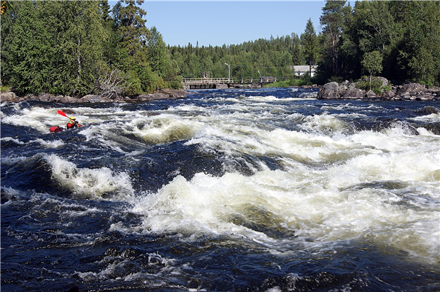
There are more than a hundred large and small rivers on the territory of the Murmansk region. Most of the rivers flow into the Barents and White Sea, some belong to the Baltic Sea basin. Many of them flow in the sparsely populated part of the Kola Peninsula, practically untouched by man.
The rivers of the Murmansk region are known primarily as fishing rivers. They are home to a large number of valuable fish species. In summer, licensed salmon fishing is allowed. There are fishing tourist camps. Also, the rivers of this region are of interest to tourists as water routes. The unique nature of the Kola Peninsula allows you to get an unforgettable experience from traveling along the rivers.
The longest rivers in the Murmansk region
List of the largest rivers flowing through the region.
Ponoy
The largest river on the Kola Peninsula. The source is located in the western part of the Keiva Upland. The estuary is a bay on the Tersky coast of the White Sea. The river is rapids; Brevenny is considered the largest rapids. In the middle reaches there is the Ponoisky zoological reserve, where rare species of animals and birds are found. The river is also a part of a fishery reserve of regional significance, the object of protection is waters and rare fish species that live in the river: salmon, pink salmon, salmon.
The length of the river is 391 km.

Varzuga
It originates in swamps in the center of the Kola Peninsula. Most of the current is located beyond the Arctic Circle. It flows into the White Sea. In the area of the upper course it is called Malaya Varzuga, after passing through Lake Varzuga it expands, this section is called Big Varzuga. The shores are mostly rocky mountains covered with forest. The current is rapids, more than 30 rapids in total. It is part of the Varzugsky nature reserve.
The length of the river is 254 km.

Lotta
The river flows in the Murmansk region of the Russian Federation and on the territory of Finland. The source is Lake Lutto in Finland, the mouth is the Verkhnetuloma reservoir. The main current is on flat terrain, but there are rapids. Crosses the village of Svetly, Kola region. Popular as an object of water tourism, there are numerous bases on the shores. Of the fish species, there are pike, grayling, perch and others.
The total length of the river is 235 km.

Kovda
It flows in the Murmansk region and in Karelia. Most of the flow is made up of lakes and reservoirs; there are three hydroelectric power plants on the river that are part of the Kovdinsky Cascade. The source is near the Kumskoye reservoir, in Lake Topozero. The shores are partly boggy taiga. It flows into the White Sea near the Kandalaksha Bay. Different sections of the river are named Sofyanga, Kuma, Kundozerka, Kovdochka.
The total length of the river is 233 km.

Strelna
The beginning of the river - the center of the Kola Peninsula, flows into the White Sea. There are no settlements along the entire river bed. Near the estuary there is an uninhabited village, which bears the name of the river; nearby is the Strelna fishing camp for licensed fishing. There are many salmon, grayling, brown trout, pink salmon and other valuable fish species in the river. 700 meters from the mouth - one of the attractions of the area, a small waterfall.
The length of the river is 213 km.

Yokanga
The source is the northeastern part of the Keiva Upland, flows into the Barents Sea in the area of Svyatonos Bay. More than a quarter of the Yokanga basin is swamps. The current is rapids, there are many waterfalls. It is planned to build several hydroelectric power plants. There are no settlements downstream. There are many fish in the river - salmon, whitefish, brown trout, pike. There are several tourist bases for fishing.
The length of the river is 203 km.

Crow
The source is located in Lovozero in the central part of the Kola Peninsula. Estuary - Crow Bay of the Barents Sea. In the lower part of the course, the river is rapids, there are many waterfalls. The largest of them is Bolshoi Padun, which is over 25 meters high. On the shores there is a deposit of gray jasper, there are places for the extraction of granite, tourmaline, beryl and other valuable minerals.
The length of the river is 155 km.

Tuntsajoki
The source of the river is in Finland, in the Varrietunturi mountain range. It flows into the Tumchu river. There are many rapids along the stream, the banks are mostly wooded and swampy, closer to the confluence with the Tumcha there is a mountainous area. Crosses the Finnish border post Kutsu and the village of Alakurtti, Kandalaksha region. Together with Tumcha, it is part of a popular tourist route for water rafting.
The total length of the river is 150 km.

Purnach
The right tributary of the Ponoi River. It flows out of Lake Maly Purnach, the entire current is located in the sparsely populated part of the Lovozersky district. There are no settlements along the river bed. The current is rapids, in the lower part of the channel flows along a narrow canyon in the mountainous area. There are many rare fish species - grayling, salmon, brown trout, whitefish. Popular as an object of water tourism.
The length of the river is 137 km.

Teriberka
The source is Lake Repyavr, which flows into the Barents Sea, forming the Teriber Bay. Downstream are the Verkhnetriiberskoe and Nizhneteriberskoe reservoirs, which belong to a cascade of two hydroelectric power plants. The riverbed is rapids, it flows through rocky mountainous terrain. The main tributary is the Muchka River. More than 300 lakes belong to the Teriberka basin. Part of the channel is the spawning area of protected fish species.
The length of the river is 127 km.
Umba
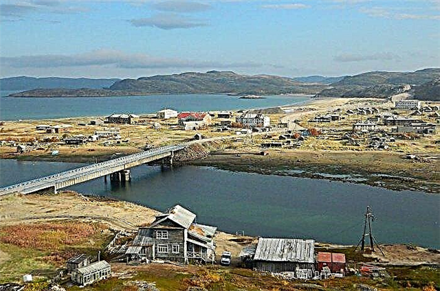
It starts from the Umb-lake near the Khibiny mountain range. The river is floatable, it was used for timber floating. The riverbed is rapids, it flows mainly through rocky and mountainous terrain. The main tributaries are the Voronya, Khariusnaya and Chernaya rivers. In the lower part of the current, the relief is more flat. It is one of the spawning rivers for valuable fish species.
The length of the river is 123 km.
Note
The source is in the Finnish National Park Urho Kennonen. The mouth is in the Verkhnetulomskoye reservoir. It crosses the border with Russia not far from Mount Korvatunturi, where according to legend lives the Finnish Santa Claus - Yolupukki. There is a natural fishing reserve on the river, where trout, salmon, grayling, whitefish, and brown trout live. The current is mostly flat, but there are rapids.
The length of the river is 120 km.

Javr
Left tributary of the Nota. The source is located in Lapland, near the Urho Kekkonenn National Park. The channel is rocky, there are many rapids and rifts. Popular as a fishing place, there are many trout, grayling, whitefish, pike, brown trout. There are tourist bases for fishing. Tributaries - Vokman, Kessemkuetskyoki, Anternjoki.
The total length of the river is 120 km.

Oriental Face
The source is Lake Litsa, the mouth is the Barents Sea. Not far from the source, the river channel bifurcates, then merges into one stream about 30 meters wide. The current is fast, there are many rapids. The attraction of the river is a waterfall about 15 meters high. Closer to the mouth, the current slows down, on the banks there are coniferous forests, a lot of mushrooms and berries. Known as a fishing spot, there are large salmon and other fish.
The length of the river is 118 km.

Patsoyoki
It flows in Finland, Norway and the Murmansk region of Russia. The source is Lake Inarijärvi. The estuary is the Varangian Bay of the Barents Sea. Most of the Russian-Norwegian border runs along the river. A cascade of seven Paz HPPs has been built downstream. Fishing is developed, mainly salmon fishing. The largest tributary is the Nautsijoki, the river crosses many lakes.
The total length of the river is 117 km.

Pan
A large right tributary of the Varzuga. The source is located not far from Mount Fedorova Tundra. The direction of the current is southeast. A lot of salmon live in the river, therefore it is popular as an object of fishing. Pana is part of the tourist rafting routes Wirma-Varzuga, Indel-Varzuga, and others. The width of the river is 20-40 meters. in different areas, in the area of the mouth it expands to 100 meters.
The length of the river is 114 km.

Chapoma
The source of the river is Lake Chapoma, the river flows in the southeastern part of the Kola Peninsula. The main attraction is the Chapomsky waterfall, 12 km upstream from the confluence of the river into the White Sea.The waterfall consists of 4 ledges, at the highest the water drop is 20 meters. Also, the river crosses the Chapomskie lakes, the channel is rapids, with a significant difference in altitude. Salmon and brown trout are found in Chapom.
The length of the river is 113 km.

Lopskaya
It flows out of Lake Mugro in Karelia, flows into Kovdozero in the Murmansk region. The sections of the river have different names - Tulle, Pudos, Mugra, Bolshaya. There are no settlements downstream. It is used for fishing and as a tourist attraction for water rafting. Popular routes are Lopskaya-Kovdozero, Lopskaya-Tyulle (the name of the river at its source), and others.
The total length of the river is 106 km.

Western Faces
The source is located in the Kuchchen-tundra tract, at an altitude of 250 meters above sea level. It flows into the Motovsky Bay of the Barents Sea, forming a fjord-lip, which is called the river. In the area of the river mouth there is a Russian Navy base, also called "Zapadnaya Litsa". The river is known as the site of the front line during the Great Patriotic War, the river valley was nicknamed "Valley of Glory".
The length of the river is 101 km.

Pechenga
It originates from Lake Piedsyaur in the western part of the Murmansk region and flows into the Barents Sea. At the source, the channel is rocky and rapids. Currently, the water is heavily polluted, as heavy metals are being produced in the river basin. On the banks of the river is the oldest monastery in the Russian North - Pechenga, which has long been the northernmost monastery in the world.
The length of the river is 101 km.

Bell
The source of the river is Lake Meliavr at the confluence of the Voronya and Kharlovka rivers. It flows into the Barents Sea. There are many rapids in the channel, there are several multistage waterfalls. It is of interest to tourists and as a fishing object. Salmon, brown trout, trout, whitefish, burbot are found, sometimes river flounder and pink salmon are found. There are tourist camps on the shores, salmon fishing is allowed.
The length of the river is 98 km.

Dry
The largest tributary of the Yokanga. It originates in the northern part of the Keiva Upland. The current is fast, the bottom is rapids, waterfalls are formed. The largest tributaries are the Semuzhya and Zolotaya rivers. Popular among water tourists, as a part of the route of Semuzhia-Iokanga, Afanasy-Yokanga, and others. There are tourist bases for fishing.
The length of the river is 97 km.

Grape
It crosses the Lovozersky and Tersky districts, flows into the White Sea on the Tersky coast. The beginning of the river is a swampy area near Lovozero. The upper course is called the Lower Razvila. Crosses the Keiva Upland. The river bed is rapids, the bottom is rocky. After crossing with Pargameevskie Keivy, the current accelerates. The river is known as a place of fishing bases, a section of the Chapoma-Yugin tourist route.
The length of the river is 92 km.

Losinga
The largest left tributary of the Ponoi River. Lake Lebyazhye and more than 10 rivers and streams flow into Losingu. Like Ponoy, it is popular with fishermen and water tourists. Salmon, grayling, brown trout are well caught. There are fishing tourist bases and parking for rafting routes. The current is winding, there are many rapids. It flows in a narrow valley in a sparsely populated area.
The length of the river is 90 km.
Moncha
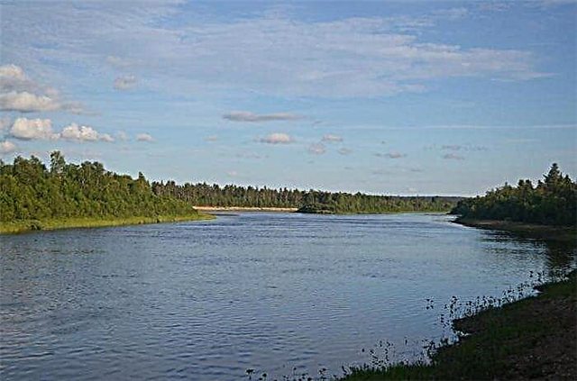
The source of the river is a mountain lake at an altitude of 450 meters above sea level. It flows into the largest lake in the Murmansk region, Imandra. It flows on the territory of the Kola region, crosses the city of Monchegorsk in the lower reaches. The river is rapids, it flows mainly in swampy areas. It also bears the names Olche, Kutskol, Monche in different areas.
The length of the river is 86 km.

Kharlovka
Source - Lyavozero, the place where it flows into the Barents Sea - the area of the village of the same name Kharlovka. Crosses lakes Nyalmozero, Pach-lake, Vundas-Yavr, Kontozero. There is Kharlov Island in the river not far from the mouth. The largest tributary is the Nekyu River. Among fishermen, it is known primarily for the abundance of salmon; there are also trout, whitefish, char, brown trout, lamprey. There are tourist camps for licensed salmon fishing.
The length of the river is 85 km.
Cola
The name of the river is supposedly derived from the Sami word meaning "golden river", or from the Finnish word for "fish river". It originates in the Kol-lake and flows into the Kola Bay. The channel is notable for its rapids with significant height differences. Located in the densely populated part of the Kola Peninsula, the largest settlement on the river is the city of Kola. It is crossed by three railway and five road bridges.
The length of the river is 83 km.

Titovka
The name comes from the mouth - Kitovka Bay, where whales from the Barents Sea were often thrown. Then Kitovka gradually transformed into Titovka. It originates in Lake Koshkaavr (Cheptyavr). There are waterfalls not far from the mouth, one of them is multistage with a total height difference of 6 meters. In summer, salmon and salmon are caught in the river, there are fishing camps. Trout, lamprey, trout, whitefish, stickleback are also found.
The length of the river is 83 km.

Pecha
The largest right tributary of the Tuloma. It originates in one of the mountain lakes, crosses Lake Imandra. Crosses the Primorsky District. The shores are mostly swampy. There are many rapids and rapids in the channel, it is popular as a tourist water route Kurenga-Pecha-Tuloma. Differs in a large number of grayling, salmon, trout, especially in the area of rifts.
The length of the river is 82 km.

Kurga
The source is in Lake Vostochny Vidpakhkyavr, the mouth is Lovozero. The tributaries are the Chernaya river, the Upper, Middle and Lower Lenyavr lakes, and Efim-lake. Before crossing with Lake Efim, the river is called Lenyavr. There are many waterfalls and rapids along the stream, the channel is rocky. It is known as a place where fishing for Atlantic salmon, brown trout and trout is allowed. Popular with tourists.
The length of the river is 81 km.


